Becoming Port Jervis, New York
Envisioned as a beacon to showcase the region’s assets and attractions as well as an information hub about the area for visitors and local communities alike, PortJervisNY.com has been fulfilling its public service mission since 1999.
Welcome to PortJervisNY.com, a public service oriented website launched in 1999 whose pages hold information and links designed to be of interest and use to visitors and Port Jervis/tri-state area residents alike.
About a two-hour drive from Manhattan, this small city of around 8,600 weds its scenic rural qualities and close knit community with a longstanding up and coming can-do spirit.
Found in Orange County where the states of New York, Pennsylvania, and New Jersey meet near the juncture of the Delaware and Neversink Rivers, the City’s neighbor on its New Jersey side in Sussex County is Montague Township while that in Pike County across the Delaware River in Pennsylvania is Matamoras in Westfall Township. Surrounding Port Jervis on the New York side is the Town of Deerpark of which it was once part.
Despite facing serious challenges posed in years past and ongoing economic headwinds, today’s stalwart downtown Port Jervis business anchors continue to show resiliency marked by what is believed to be the tallest building ever constructed in the city rising in their midst: a seven story hotel with rooftop bar.

Coupled with the $10 million Downtown Revitalization Initiative grant New York State awarded Port Jervis in March 2023 as well as news received in August that $100 million in State funds earmarked for a major improvement to commuter train service, it would be hard to deny that the time for Port Jervis to shine again appears close at hand. This momentum is spurred further still by the energy of enthused, capable and committed newer arrivals inspiring and working with hometown residents.
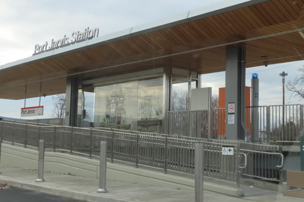
More proof is evidenced by improvements made to the City’s infrastructure such as a new Tri-States bridge, sidewalks, continued relining of sewer pipes and a state-of-the art train platform. Likewise the City annexing approximately 122 acres in January 2023 that are slated for a range of commercial development purposes points in the same forward moving direction.
That in recent years Port Jervis has seen citizen led initiatives in partnership with the City and others develop 60 miles of public hiking and biking trails in its Watershed Park, the arrival of vintage railroad equipment and a growing number of events hosted by the Port Jervis Tourism Board is yet another example of this encouraging trend proving true.
PortJervisNY.com aims to continue to serve the purposes for which it is designed so please browse our pages for more.